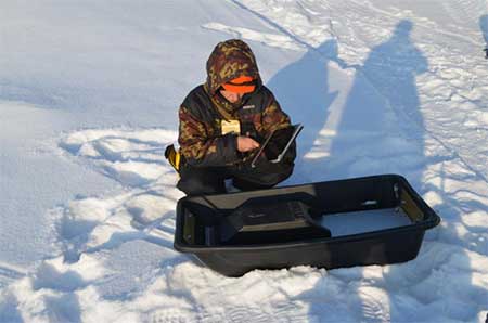
The purpose of the GPR survey is to estimate the volume of oil sludge. The oil sludge collector is a hollow bounded by two dams. GPR profiling was carried out by the antenna with a central frequency of 100 MHz in the winter time in the frozen surface of the sludge collector. The figures below show the antenna unit of the GPR, located in a specialized radio-transparent sled, as well as a towing device, which ensures a uniform speed of the GPR profiling:
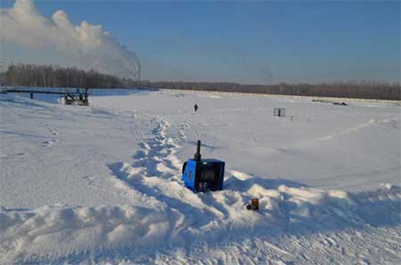
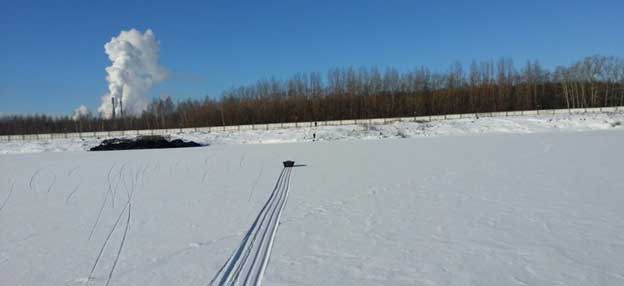
The GPR antenna block crosses the water area of the sludge collector:
The figure below shows one of the GPR profiles obtained during the survey of the sludge collector:
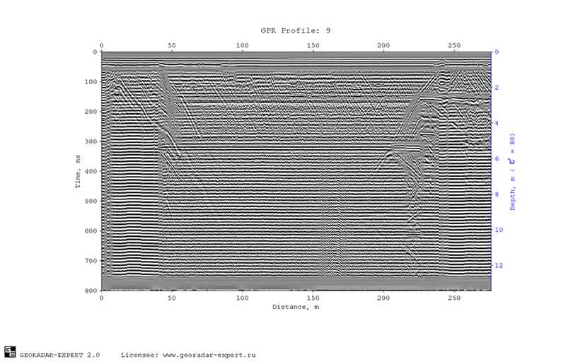
On the GPR profile, intense reflections are observed from ice inhomogeneities, from shores, structural elements of the sludge collector, and other objects on the surface. The bottom of the sludge collector on the GPR profile cannot be traced due to the strong attenuation of the GPR signals in the thickness of the waste and the low dielectric contrast between the waste and the underlying soil.
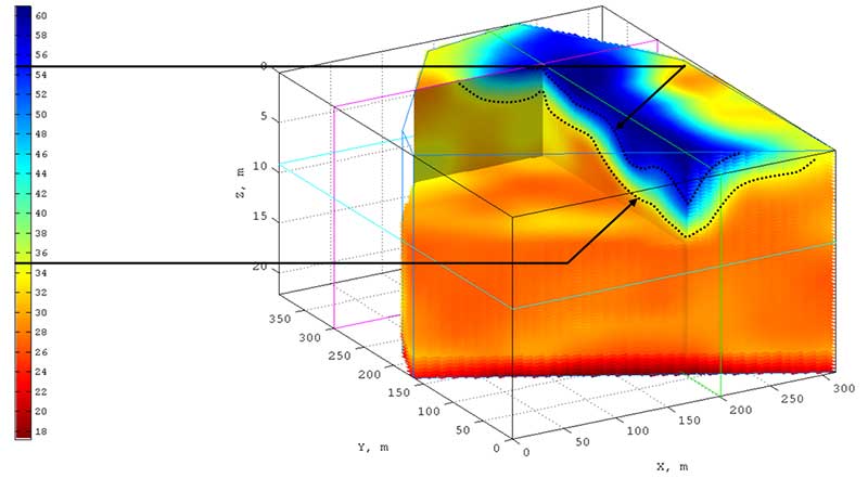
The use of automated backscatter field analysis (BSEF) allowed us to solve the problem of extracting the bottom profile. From the sections of the real part of the complex relative permittivity, a 3D assembly was formed. The figure below shows an array of 3D assembly and the position of the GPR profiles:

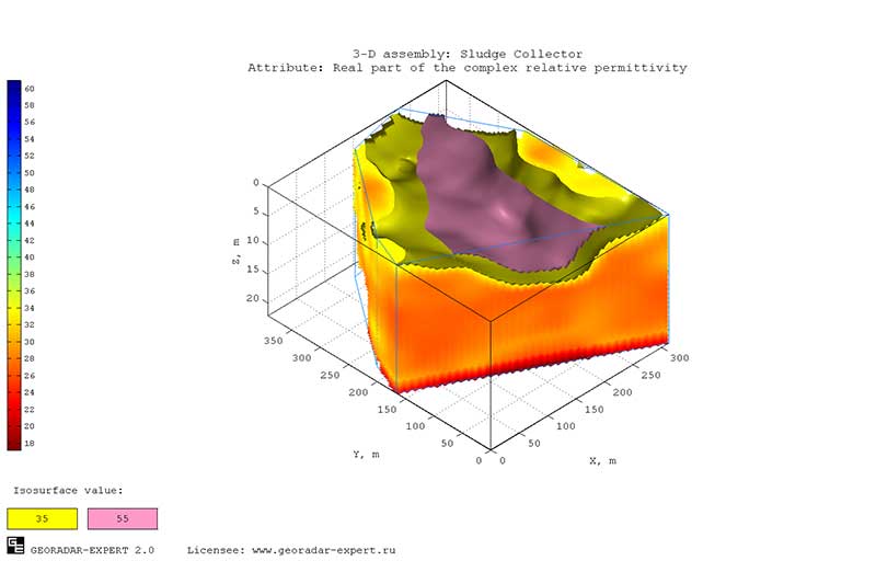
On the basis of information on the position of the coastline on the GPR profiles, the permittivity value 35 was determined, which corresponds to the boundary between the bottom of the sludge collector and the waste. Waste in sludge collector has solid and liquid fractions. There is no sharp boundary between these fractions, and the value of the permittivity 55 to determine the conditional boundary between the fractions was selected on the basis of a priori information about the sludge collector and visual analysis:
The figures below show isosurfaces passing through the values of permittivity 35 (bottom relief) and 55 (conditional boundary between the solid and liquid fractions of waste):

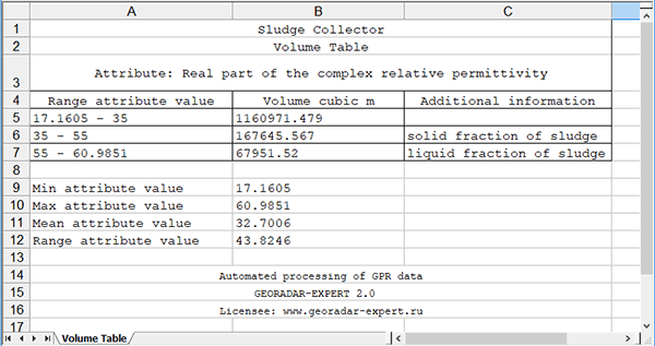
Based on the isosurfaces, the GEORADAR-EXPERT software system calculated the volumes of the layers limited by the isosurfaces and array boundary of the 3D assembly and formed a table in MS EXCEL format:
Thus, as a result of the application of the automated BSEF analysis method, implemented in the GEORADAR-EXPERT software system, despite the strong attenuation of the GPR signal and intense reflection-interference from objects on the surface, the task of detecting the bottom of the sludge collector, as well as solid and liquid fractions in oil waste successfully resolved.